Skip to content
Summer University 2026

About the Program

A modern, practice-based summer format for mountain risk learning

The program connects cryosphere science, GIS and remote sensing, field observation, and disaster risk management in one focused learning journey.

Cryosphere scienceGIS and remote sensingField-based risk practice
Regional mountain hazard context

Regional hazard landscapes shape the agenda

01

Introduction

Applied learning environment in a mountain setting
Applied sessions connected to real terrain

In 2025, the International Year of Glaciers’ Preservation and the UN Decade of Action for Cryospheric Sciences (2025–2034) placed global attention on the accelerating transformation of glaciers, snow, and permafrost. The International Year is accompanied by the establishment of the World Day for Glaciers (21 March, starting in 2025). These changes are reshaping mountain environments worldwide, with profound consequences for water security, ecosystems, infrastructure, and human safety – particularly in regions already facing social and economic pressures.

Further strengthening this agenda, on 13 August 2024, the United Nations General Assembly adopted a resolution (A/78/L.99) proclaiming 2025–2034 as the “Decade of Action for Cryospheric Sciences.” Initiated by the Republic of Tajikistan and the French Republic, the focus of the decade will be on enhancing international scientific collaboration, expanding research capacity, and supporting evidence-based decision-making to address rapid glacier mass loss, permafrost degradation, and the increasing risks of cryosphere-related natural hazards, particularly in mountain regions.

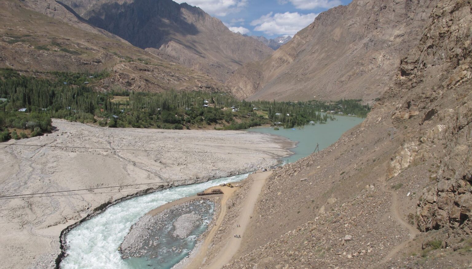
Central Asia stands at the forefront of these challenges. In Tajikistan, where more than 93% of the territory is mountainous and arable land is scarce, climate change, population pressure, and intensifying weather extremes are driving a rise in floods, landslides, debris flows, and glacial lake outburst floods (GLOFs). Across the Pamir, Hindu Kush, Tien Shan, and Karakoram ranges, glacier retreat and expanding glacial lakes pose growing threats to mountain and downstream communities, exposing critical gaps in risk governance and land-use planning.

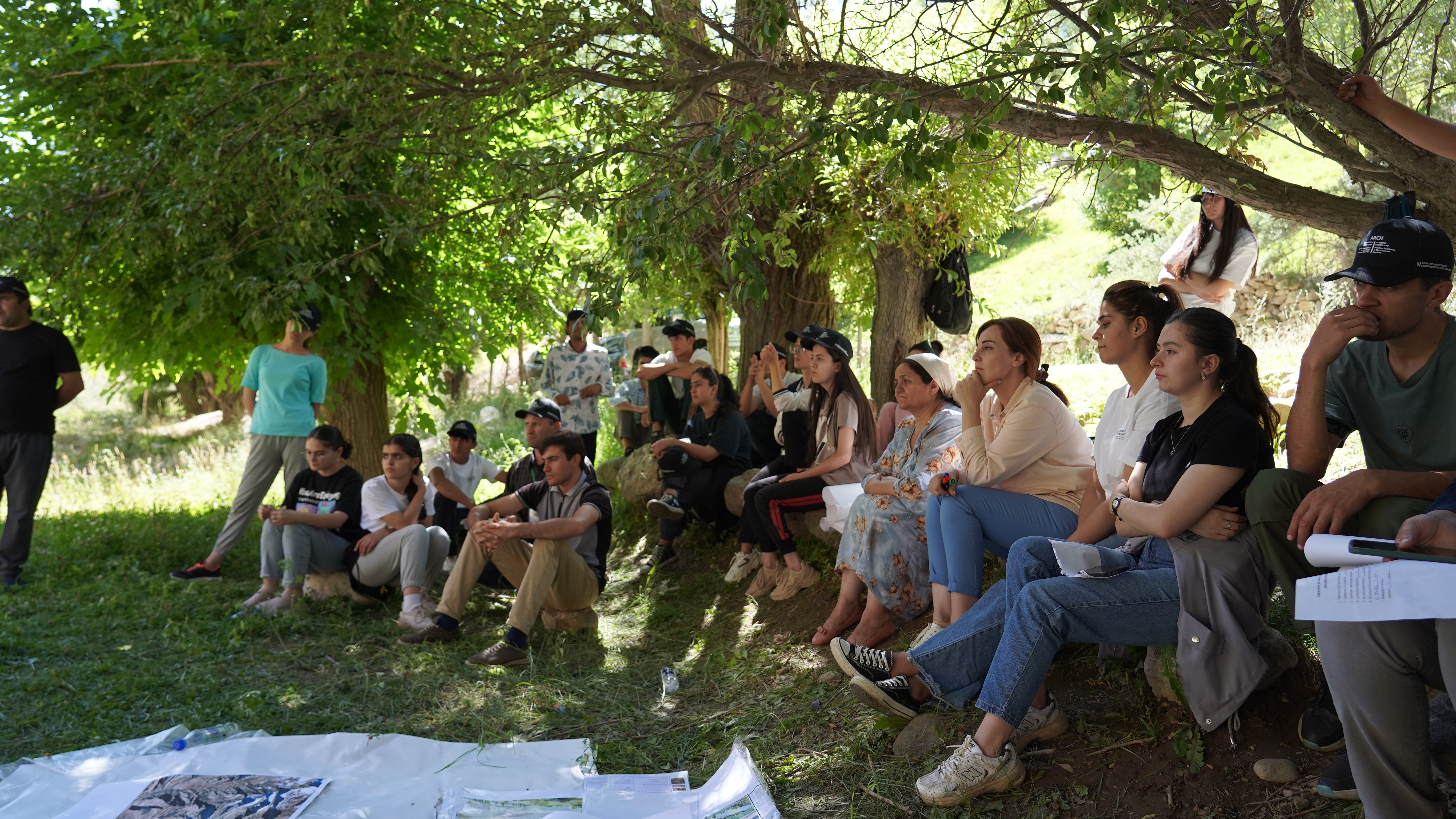
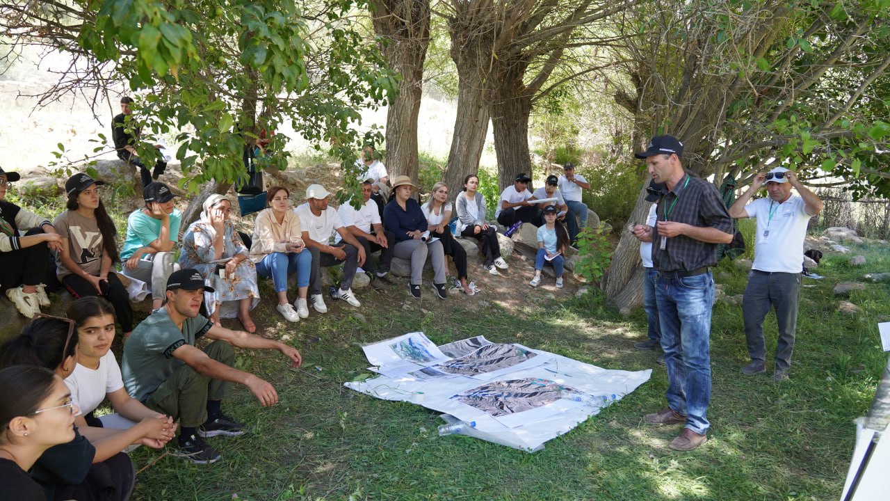
This Summer University Program responds to these urgent realities by strengthening capacity in cryosphere risk understanding and management. Its core objective is to equip participants with applied knowledge and analytical skills to identify cryosphere-related hazards, understand their physical drivers and cascading impacts, and evaluate risk in the context of climate change, exposure, and vulnerability.

In this context, the University of Central Asia (UCA) and the Aga Khan Foundation (AKF), in partnership with Khorog State University, are organizing a Summer University Program on “Understanding Cryosphere Hazards: Integrating Glaciers, Glacial Lakes, and Permafrost” under the Adaptive and Resilient Communities in their Habitat (ARCH) initiative, financially supported by the Government of Switzerland through the Swiss Agency for Development and Cooperation (SDC).

02

Program Brief

Regional mountain hazard context
Regional hazard landscapes shape the agenda

The goal of the Summer University is to strengthen applied capacity to assess and manage cryosphere-related hazards in mountain environments by integrating cryosphere science, GIS/remote sensing, and disaster risk reduction/management (DRR/DRM) practice.

03

Program Objectives

Topographic texture and terrain surface
Terrain reading and spatial interpretation

The overall aim of the course is to equip participants with applied knowledge and analytical skills to understand cryosphere-related hazards, their physical drivers, cascading impacts, and management strategies, with a strong emphasis on GIS and remote sensing–based analysis and decision support. The program focuses on the causes, dynamics, and consequences of cryosphere hazards—including glacier retreat, glacial lake outburst floods (GLOFs), permafrost degradation, and ice- and snow-related mass movements in Central Asia—and their responses to climate change, along with their impacts on exposure and vulnerability. By the end of the program, participants will have:

  • Develop a working understanding of the main cryosphere hazard processes and their drivers relevant to Central Asia (glacier change, glacial lakes/GLOFs, permafrost degradation, snow/ice-related mass movements) and how they interact with exposure and vulnerability.
  • Build practical competence in GIS and remote sensing workflows for hazard delineation, exposure mapping, and risk-informed decisions.
  • Applied an integrated DRR/DRM framework to identify feasible mitigation, adaptation, preparedness, and response options suitable for mountain and cold-region contexts.
  • Produced an evidence-based, map-supported “risk briefing” (group capstone), translating technical analysis into actionable recommendations for planners and practitioners.
04

Learning outcomes

Mountain region learning context
From observation to decision-ready analysis

The course brings together students, researchers, and practitioners from diverse backgrounds to exchange knowledge and develop interdisciplinary perspectives on cryosphere hazards. By the end of the program, participants will be able to:

  • Explain cryosphere processes (glacier mass balance and retreat, glacial lake formation, permafrost thaw) and describe how they generate hazards and cascading impacts.
  • Interpret and apply remote sensing products (e.g., optical imagery, DEM-derived terrain metrics) and select appropriate datasets for hazard analysis in mountain terrain.
  • Delineate hazard zones for at least two hazard types (e.g., GLOF susceptibility, debris-flow/landslide susceptibility) using transparent GIS workflows.
  • Conduct exposure assessments by integrating hazard layers with settlement/infrastructure data and summarize who/what is most exposed.
  • Apply vulnerability analysis (social, institutional, physical) to identify priority risk drivers beyond hazard magnitude alone.
  • Synthesize hazard, exposure, and vulnerability evidence into an integrated risk narrative and communicate results using maps and a short technical brief.
  • Recommend risk reduction and preparedness options, justifying them with reference to feasibility, uncertainty, and governance constraints in mountain regions.
05

Topics of the Training Program

Mountain region and community setting
Community context remains part of the story
  • Understanding the fundamentals of cryosphere hazards, including glacier retreat, glacial lake formation and outburst floods, permafrost degradation, and snow- and ice-related mass movements, while analyzing their cascading impacts on communities and infrastructure.
  • Building a foundation in remote sensing and GIS for mountain hazards, with emphasis on data sources, preprocessing, terrain analysis, and uncertainty, and applying these tools to hazard mapping and exposure assessment.
  • Developing introductory skills in glacial lake and GLOF assessment, including identification, susceptibility screening, and downstream impact pathways, combined with basic debris-flow modeling to understand community-level risks.
  • Advancing knowledge of permafrost assessment by examining indicators, terrain controls, and implications for infrastructure stability, while exploring nature-based solutions for stabilization and climate resilience.
  • Applying integrated approaches to hazard mapping, exposure analysis, and vulnerability assessment, using specialized GIS tools and applications to link spatial data with disaster risk management strategies.
  • Strengthening competence in vulnerability, risk, and disaster management by connecting theoretical concepts with practical applications, and by evaluating cascading risks and prioritization in mountain and cold-region contexts.
  • Practicing GIS-based analysis and group exercises that connect field data with risk-informed decision-making, thereby fostering interdisciplinary collaboration and applied learning.
  • Conducting field visits to observe cryosphere processes and hazards directly, linking practical observations with GIS workflows, and translating them into actionable insights for risk reduction.
  • Exploring community-based early warning systems that bridge high-level satellite monitoring with low-cost local management and immediate action, thereby enhancing preparedness and resilience.
  • Examining climate-resilient land use planning by identifying high-risk zones, restricting infrastructure development in vulnerable areas, and promoting adaptive governance strategies for sustainable mountain development.
06

Program Specifics

The 14-day program is scheduled to take place from June 1 to June 14, 2026, at the University of Central Asia (UCA) campus in Khorog, Tajikistan. This intensive initiative will host 30 participants between the ages of 22 and 35 who hold degrees in GIS, geography, engineering, geoscience, environmental science, or social science, and possess foundational experience in disaster management and climate change. While the primary language of instruction is English, full interpretation in Tajik and Russian will be provided to ensure comprehensive understanding. To facilitate full participation, the program is fully funded, with all expenses related to meals, accommodation, and local transportation covered for the duration of the stay.

07

Target Audience

The program will target international and national audiences. The Summer University will bring together early-career researchers, university students, practitioners, and specialists.