Lecturers and Speakers
Meet the lecturers, mentors, and invited experts shaping the Summer University program.
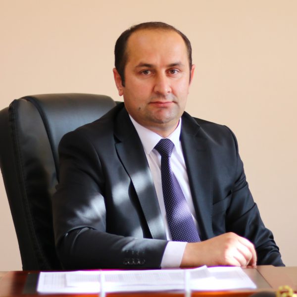
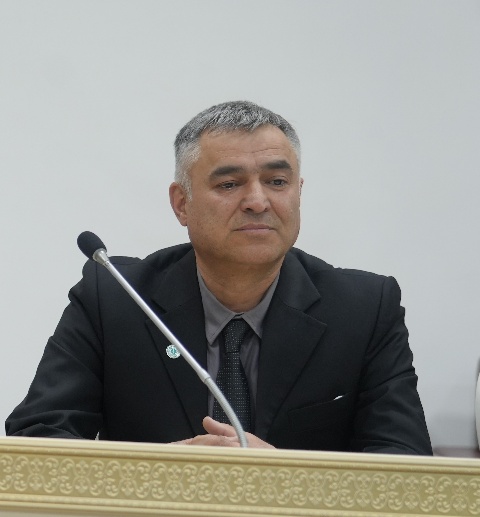
Komilbek Amid Yorbek
Doctor of Political Sciences, Professor
Dr. Komilbek Amid Yorbek has studied political sciences and specializes in the field of political governance and political systems. He was born in 1985 in the Shughnon district and graduated from Khorog State University named after M.Nazarshoeva in 2009. In 2014, he defended his PhD dissertation on the topic of political governance, and in 2023, he defended his doctoral dissertation on the political governance system in Republic of Tajikistan. He is the author of 3 monographs, 38 scientific articles, and a textbook for universities. His professional career has included positions as an assistant, teacher, head of department, dean, and vice-rector at higher educational institutions in Tajikistan, including the Tajikistan University of Technology, Tajik National University and Academy of Public Administration under the President of the Republic of Tajikistan.
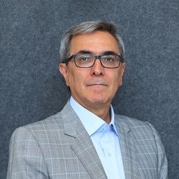
Mohssen Moazzen
Professor of Earth and Environmental Sciences
Professor Mohssen Moazzen is an Academic Programme Director, Professor of Earth and Environmental Sciences (EES) at UCA’s School of Arts and Sciences. His major interests include the application of petrology, geochemistry, and mineralogy to study the geodynamics of the Earth's crust, mantle petrology, and evolution of the mountain belts. He also has worked on mineral resources, especially porphyry copper, gold, and molybdenum deposits from a geodynamic perspective. He has worked as an Associate Professor and full-time Professor at the University of Tabriz, where he taught several courses for undergraduate and graduate students. He was also a supervisor for 15 Ph.D. and more than 30 M.Sc. students. Professor Moazzen has research experience as a Post-Doctorate Fellow at the University of Manchester (1999-2000), Associate Researcher at Potsdam University of Germany (2005-2006), and Research Professor at the Wollongong University in Australia (2018-2019). He holds a Ph.D. from Manchester University in the United Kingdom.
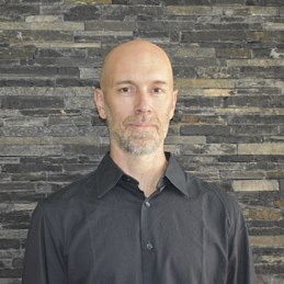
Denis Samyn
Associate Professor of Earth and Environmental Sciences
Dr Denis Samyn is Associate Professor of Earth and Environmental Sciences (SAS), Senior Cryosphere Researcher at the Mountain Societies Research Institute (MSRI). He is an environmental geologist and glaciologist interested in glacier systems and the cryosphere in both polar and high-altitude regions. At the University of Central Asia (UCA), Dr Samyn is jointly appointed as an Associate Professor at the School of Arts and Sciences (SAS) and as a Senior Cryosphere Researcher at the Mountain Societies Research Institute (MSRI) in Tajikistan. His work centers on glacier, snow, and permafrost dynamics in Central Asia, especially the Pamirs, and contributes to earth science and cryosphere education in the region. Dr Samyn holds an MSc in Geology from the Catholic University of Louvain, and a PhD in Glaciology/Geology from the Free University of Brussels in Belgium. Through his diverse doctoral and postdoctoral experiences at the University of Brussels in Belgium (FRIA & BELSPO Fellowships), the University of Uppsala in Sweden (Marie Curie Fellowship), the University of Nagaoka in Japan (JSPS Fellowship), and the Royal Museum for Central Africa in Belgium (Marie Curie Fellowship), Dr. Samyn developed a broad expertise in cryospheric processes across various climatic and altitudinal zones in several continents. Dr Samyn’s interdisciplinary research combines geochemistry, geophysics, microbiology, satellite remote sensing, field instrumentation, and modeling to study cryospheric and high mountain landscape dynamics. His publications span topics such as basal ice and marine ice processes, glacier-climate interactions, the structure and chemistry of snow and ice, ice core paleoclimatology, and frozen ground and permafrost processes. His work contributes to global efforts in understanding past environments and climate change through the lens of the cryosphere, and supports sustainable development initiatives in vulnerable high-mountain regions.
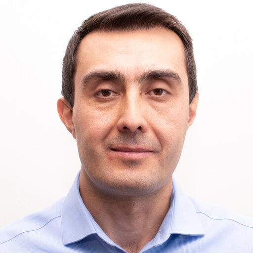
Murodbek Laljebaev
PhD in Natural Resources, Associate Director, Mountain Societies Research Institute
Dr Murodbek Laljebaev is a Senior Research Fellow and Associate Director at the Mountain Societies Research Institute (MSRI), Graduate School of Development (GSD), University of Central Asia (UCA). Based at UCA’s Khorog campus (Tajikistan), he provides strategic, academic, and operational leadership in support of MSRI’s mission and regional impact. He bridges scholarship and practice through regional projects and advisory work, including as Assessment Lead for the World Bank–related Youth Climate Action for Central Asia initiative (2022–2024). His consulting also includes analysis of energy poverty and tariff liberalization impacts for the International Labor Organization (Uzbekistan) and applied assessments supporting food security and livelihoods initiatives in GBAO for Aga Khan Foundation (Tajikistan). Earlier in his career, he held roles spanning curriculum and evaluation leadership in Tajikistan, including work with the World Bank on teacher training program evaluation and service as a Senior Specialist in the Ministry of Economic Development and Trade supporting Tajikistan’s WTO accession process. Dr Laljebaev previously served as an Associate Professor at Nazarbayev University (2023–2025), an Assistant Professor at UCA (2017-2022), and held academic leadership roles at Nazarbayev University as Faculty Senate representative, and at UCA as Chair of the Department of Social Sciences and Humanities (2022) and Program Lead of the Earth and Environmental Sciences Program (2017-2019). He has taught a diverse set courses such as Human Geography, Ways of Knowing, Environmental Governance, Global Energy Policy, Energy Systems & Climate Policy, Sustainable Energy, and Natural Resource Management and Policy. He holds a PhD in Natural Resources (Cornell University), a Mater in Public Policy (National University of Singapore, Lee Kuan Yew School of Public Policy), and a BA in Linguistics (English) (Khorog State University), and works professionally in Tajik, English, and Russian.
Yusuf Raimbekov
Senior Geologist
Dr. Yusuf Kh. Raimbekov is a geologist specializing in disaster risk reduction, geological hazard mapping, and high-altitude lake outburst flood assessment. His research focuses on the geology of mountainous regions, bathymetric surveying of hazardous lakes, and mathematical modeling of potential outburst floods. His work integrates field geology, remote sensing, and numerical modeling to understand and mitigate natural hazards in high-mountain environments. Dr. Raimbekov holds a PhD in Geology and Mineralogy. He has over ten years of professional experience in the field of disaster risk reduction. Currently, Dr. Raimbekov serves as a Senior Geologist for the Disaster Risk Reduction (DRR) program of the Aga Khan Foundation in Tajikistan, based in Khorog. In this role, he is responsible for geological hazard mapping, bathymetric surveying of high-altitude outburst-prone lakes, and mathematical modeling of potential lake outbursts.
Vitalii Zaginaev
Senior Research Fellow, Mountain Societies Research Institute
For the last 15 years, Dr Vitalii Zaginaev has been researching dangerous exogenous geological processes, such as debris flows, landslides, rockfalls, avalanches, etc. in the Kyrgyz Republic, including the northern and southern regions of the republic. Since 2008, he has been researching potential hazardous high mountain lakes (GLOF). In 2016, he defended his thesis on the topic “Dynamics of debris flows of the Northern Tien Shan”, where one of the chapters was devoted to the reconstruction of past debris flows using the dendrochronological method, in close cooperation with the University of Bern, Switzerland. From 2019 to 2020, Dr Vitalii Zaginaev continued his scientific career at Charles University, Prague, as a postdoc, where he worked under the guidance of Professor Bogumir Jansky on the study of the formation and development of high mountain lakes in the Kyrgyz Republic. Since 2021, he began working in the civil service in the Department of Monitoring and Forecasting of Emergency Situations under Ministry of Emergencies Situations as the head of the Analysis and Forecasting Division. He has scientific publications in international peer-reviewed journals, one monograph on “Potential Hazardous Lakes of the Kyrgyz Republic”. Dr Vitalii Zaginaev is a member of the International Mudflow Association, the Scientific and Technical Council of the Ministry of Emergency Situations of the Kyrgyz Republic and the Dissertation Council of the Institute of Water Problems and Hydropower of the National Academy of Sciences of the Kyrgyz Republic.
Ubaidullo Pirmamadov
Geology Supervisor
Ubaidullo Pirmamadov is a geologist specializing in natural disaster risk assessment, geological hazard mapping, and disaster risk reduction. His work integrates multi-hazard risk assessments (floods, landslides, avalanches, rockfalls), field geology, GIS and remote sensing, bathymetric surveying, and mathematical modeling to understand and mitigate natural hazards across all provinces and districts of the Republic of Tajikistan.Pirmamadov has over 28 years of professional experience in the field of natural disaster risk assessment, hazard mapping, and the development of recommendations for disaster mitigation or risk reduction. Of these, five years were spent in government agencies and 23 years with the Aga Khan Foundation (AKF). Currently, Pirmamadov serves as the Supervisor of the Geology Unit within the Disaster Risk Reduction (DRR) department of the Aga Khan Foundation in Tajikistan, based between Khorog and Dushanbe. In this role, he provides professional leadership for geological activities aimed at assessing and mitigating natural disaster risks in vulnerable areas, in accordance with international standards. His responsibilities include leadership and coordination of the geology unit's activities, conducting multi-hazard risk assessments, developing hazard maps and reports, supervising fieldwork and monitoring, applying GIS and remote sensing, and collaborating with government institutions, donors, and local communities. He also supervises, reviews, and checks all geological work of the department, including reports, summaries, geological assessment maps, bathymetric and modeling work, hazard maps, and proposed mitigation plans.
Arnaud Caiserman
Senior Research Fellow, Mountain Societies Research Institute
Dr Arnaud Caiserman is a Senior Research Fellow at University of Central Asia (Khorog, Tajikistan). He has broad training in physical geography with an emphasis in spatial analysis using advance remote sensing methods and Geographic Information Systems (GIS). In addition to his current research in Tajikistan and Afghanistan, Dr Caiserman conducted studies on water resources management and agricultural land degradation in drylands of Iran and Lebanon. He is author or co-author on 10 scientific papers. Current research focal areas include snow avalanches long-term mapping, glacier velocity mapping in the Pamirs; snow water equivalent measurements in Tajikistan; snow line and coverage evolution in the Panj River catchment; and sediment transport in the Vakhsh River, Tajikistan. Dr Caiserman also offers occasional lectures in remote sensing and earth science at University of Central Asia.
Sanjar Sadyrov
Research Fellow, Mountain Societies Research Institute
Dr Sanjar Sadyrov is a Research Fellow at the University of Central Asia’s Mountain Societies Research Institute. He holds Ph.D. in Engineering from Kyoto University (Japan). He received his Master's Degree from the Graduate School of Engineering, Kyoto University and BSc in Engineering Hydrogeology from the Kyrgyz State Technical Univesity. Over the past decade, his research endeavors have been dedicated to the exploration of various aspects of the Earth, with a particular emphasis on conducting in-depth studies related to water. His current area of expertise lies in the assessment of water resources in mountainous regions, with a specific emphasis on glaciers and the potential ramifications of climate change on these vital water sources. Since 2017, he has actively participated in establishing a network for meteorological observations on glaciers in Tien-Shan Mountains and meticulously analyzing the acquired data to integrate it into glaciological and hydrological models.
Inom Zikilobekov
GIS Specialist, OR&T
GIS Specialist in OR&T at Aga Khan Foundation Tajikistan. Theme areas: GIS, WebGIS, and spatial data preparation.

Hofiz Navruzshoev
Research Fellow, Mountain Societies Research Institute
Prior to joining UCA, Hofiz worked as a senior researcher at the Centre for the Study of Glaciers of the National Academy of Sciences of Tajikistan. He also worked as an assistant in the Department of Mathematics at Khorog State University. Hofiz has attained a PhD degree from the Institute of Water Problems, Hydropower and Ecology of the National Academy of Sciences of Tajikistan and a master’s degree from the St. Petersburg National Research University of Information Technologies, Mechanics and Optics, Faculty of Information and Computer Technology.
Haniyeh Asadi
Research Fellow, Mountain Societies Research Institute
Dr Haniyeh Asadi is a Research Fellow at the University of Central Asia’s Mountain Societies Research Institute. She holds a Ph.D. in Watershed Management Science & Engineering from Sari Agricultural Sciences and Natural Resources University (SANRU), Iran. She earned her Master's degree in Natural Resources Engineering from Tarbiat Modares University and her Bachelor's degree from the University of Mazandaran. Dr Asadi continued her scientific career as a postdoctoral researcher at Ferdowsi University of Mashhad, Iran, under the guidance of Professor Mohammad Taghi Dastorani and Professor Roy C. Sidle, working on modeling the hydrological connectivity index using smart algorithms. Over the past decade, her research has focused on various aspects of catchment hydrology, particularly the application of GIS, remote sensing and machine learning techniques in hydrologic studies. Her current expertise lies in the assessment and modeling of sediment in mountainous regions, particularly in areas with snow, glaciers, and permafrost.
Aslam Qadamov
Research Fellow, Mountain Societies Research Institute
Dr Aslam Qadamov is a Research Fellow at UCA’s MSRI (Khorog, Tajikistan). Dr Qadamov has a background in agriculture and soil sciences. He completed his PhD on wind erosion effect on cultivated land, where he used quantitative and qualitative methods, remote sensing data and GIS to assess the impact of wind erosion on soil quality and crop production in high valleys of Vakhan, Tajikistan. Dr Qadamov contributed to several national and international projects in Tajikistan and Afghanistan and has a broad experience in water conservation, natural resource management and agriculture. Currently he is engaged in assessing the impact of the changing climate to water availability and crop production in high valleys of Pamir. Dr Qadamov has authored or co-authored 11 research papers. Dr Qadamov is also lecturing on water conservation and GIS at Khorog State University, Tajikistan.
Nalan Lom
Assistant Professor, School of Arts and Sciences
Dr Nalan Lom is a geologist with a background in geophysics whose research focuses on the large-scale evolution of orogenic systems and the plate-kinematic reconstruction of ancient tectonic domains. Her work integrates palaeomagnetism, stratigraphy, mantle tomography, and field geology to understand the deformation and dynamics of convergent margins from Precambrian to Cenozoic. Dr Lom earned her PhD in Solid Earth Sciences (2017) from the Eurasia Institute of Earth Sciences, Istanbul Technical University (ITU). During her doctoral studies, she received a research scholarship at the Centre for Earth Evolution and Dynamics (CEED), University of Oslo, Norway, and later continued as a Post-Doctoral Research Fellow at ITU (2017–2019). Dr Lom worked at Utrecht University (2019-2023) in the Netherlands as part of the EU-funded TRIGGER project (Tracing the Regional Initiator of the Great Global Eocene Plate Reorganization), where she investigated the palaeogeography of the Tethys region and the tectonic evolution of orogenic belts. She also contributed to teaching and co-supervised MSc students. Before joining the UCA, Dr Lom held a researcher and lecturer position at Heidelberg University in Germany (2024–2025), where she coordinated courses on geodynamics and structural geology.
Muslim Azimshoev
Senior Research, OR&T
Muslim Azimshoev is a geologist specializing in engineering geology, hydrogeology, and geophysical investigations, whose research focuses on permafrost assessment, groundwater exploration, and geological hazard analysis in Central Asian mountain environments. His work integrates Electrical Resistivity Tomography (ERT), remote sensing, and field geology to understand subsurface conditions, water resources, and geohazards in complex terrain. Azimshoev has over 12 years of professional experience in engineering geology, hydrogeology, and geophysical investigations, with extensive work throughout Central Asia. Currently, Dr. Azimshoev serves as a Senior Researcher, where he is responsible for permafrost assessment, groundwater exploration, and geological hazard analysis using advanced methods such as ERT and remote sensing.
Dilovar Qurbonmamadov
GIS Supervisor
GIS Supervisor at Aga Khan Foundation. Theme areas: GIS and remote sensing, hazard and risk mapping, GLOF modeling, spatial data analysis, and disaster risk management.

Amir Ghulomaidarov
Senior GIS Specialist
Mr. Amiraidar Ghulomaidarov is a Senior GIS Specialist based in Khorog, GBAO, Tajikistan, whose work focuses on geospatial analysis, remote sensing, and drone-based data collection for disaster risk reduction, environmental monitoring, and resilience building in mountainous and high-risk environments. His expertise integrates satellite imagery, UAV data, echo-sounder measurements, and field surveys into GIS platforms to develop thematic maps, 3D models, spatial analyses, and bathymetric surveys for risk assessment, glacial and mountain lake monitoring, and environmental studies. Mr. Ghulomaidarov has been working in the GIS field since 2012, initially with FOCUS Humanitarian Assistance, where he contributed to humanitarian mapping, disaster risk reduction, and environmental monitoring. Since June 2025, he has been serving as a Senior GIS Specialist at the Aga Khan Foundation (AKF), supporting spatial analysis, mapping, and data-driven decision-making for development and resilience projects. He has over ten years of professional experience in his field. In 2026, Mr. Ghulomaidarov completed the Fundamental Geological Mapping and Geological Interpretation course at the Geological Survey of India (GSI) in Hyderabad, strengthening his skills in geological interpretation, structural analysis, and the integration of geological data with GIS and remote sensing workflows. He is proficient in ArcGIS, AutoCAD, Pix4D, eMotion, and related GIS and image-processing software. He also contributes to capacity building, providing training on GIS, UAV operations, bathymetric equipment, and data processing methodologies.